top of page


«ALL WHAT YOU CAN SEE IN REAL LIFE, MIGHT BE TRANSFERRED TO DIGITAL DATA»

ABOUT US
What are LAPLACE?
Laplace was founded in 2011 by engineers with excellent knowledge and international experience in topo-geodesy and Dimensional Control Survey. The diversity of activities covers not only onshore but also offshore facilities.
About Us

Products

SURVEY AND ANALYSİS
OF REAL WORD
All objects around us have specific coordinates.
Our company helps to transfer reality to screen of your display.


The services provided by our company contribute to the provision of material that will help you, save your money, resources, time, eliminate the risks of error, allow you to visually study the action plan, increase the level of security
OUR SERVICES:
We provide high quality services with very tide prisized tolerances.
Digital data include as-built information with integrated 3d design.
○ Spool Survey
○ Like to Like (RO) Survey
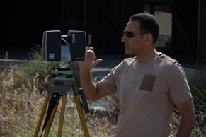
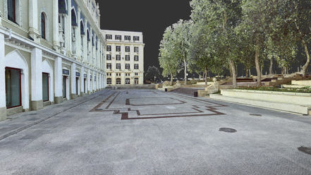
○ 3D laser Scanning
○ Structural Survey
○ Survey on Constructions/topsides
○ 360° Interactive Virtual Tour
○ Corridor Survey
○ Topographic Survey
○ 3D Simulation/Visualization
Services

GALLERY OF OUR PROJECTS
Gallery
LAPLACE
3D SCANNING AND SURVEY
ASK FOR REQUEST
contacts
bottom of page


